|
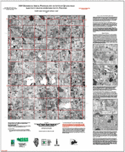
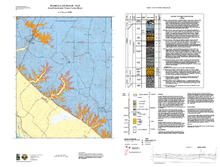
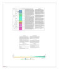
1939 Historical Aerial Photography of Antioch Quadrangle, Lake County, Illinois and Kenosha County, Wisconsin |
34" x 28" single map sheet; includes descriptive text, and inset views (4)
|
Antioch |
Aerial Photography |
|
Illinois Preliminary Geologic Map Series (IPGM) |
2005 |
Donald E. Luman, Deete M. Lund, Bryan J. Luman |
|
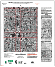
1998-1999 Digital Orthophotography of Antioch Quadrangle, Lake County, Illinois and Kenosha County, Wisconsin |
34" x 28" single map sheet; includes legend, descriptive text, and inset map
|
Antioch |
Orthophoto Imagery |
|
Illinois Preliminary Geologic Map Series (IPGM) |
2005 |
Donald E. Luman |
|
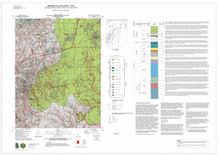
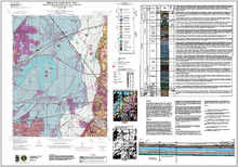
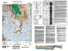
Bedrock Geologic Map, Collinsville Quadrangle, Madison and St. Clair Counties, Illinois |
46" x 32.5" single map sheet, contains map, legend, descriptive stratigraphic column, and descriptive text
|
Collinsville |
Bedrock Geology |
STATEMAP |
|
2001 |
Joseph A. Devera, F. Brett Denny |
|
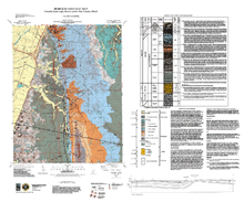
Bedrock Geologic Map, Columbia Quadrangle, Monroe and St. Clair Counties, Illinois |
34" x 41" single map sheet, contains map, legend, descriptive stratigraphic column, and descriptive text
|
Columbia |
Bedrock Geology |
STATEMAP |
|
2000 |
Joseph A. Devera |
|
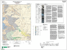
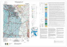
Bedrock Geologic Map, Monks Mound Quadrangle, Madison and St. Clair Counties, Illinois |
31" x 45" single map sheet, contains map, legend, descriptive text, cross section, descriptive stratigraphic column, and 2 figures
|
Monks Mound |
Bedrock Geology |
STATEMAP |
|
2001 |
F. Brett Denny, Joseph A. Devera |
|
Bedrock Geologic Map, Paderborn Quadrangle, Monroe and St. Clair Counties, Illinois |
33" x 43" single map sheet, contains map, legend, descriptive stratigraphic column, cross section, and descriptive text
|
Paderborn |
Bedrock Geology |
STATEMAP |
|
2002 |
Joseph A. Devera |
|
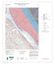
Bedrock Geologic Map, Renault Quadrangle, Monroe County, Illinois |
34" x 41" single map sheet, contains map, legend, descriptive stratigraphic column, cross section, and descriptive text
|
Renault |
Bedrock Geology |
STATEMAP |
|
2000 |
Joseph A. Devera |
|
Bedrock Geologic Map, Selma Quadrangle, (Illinois Portion), Monroe County, Illinois |
33" x 41" single map sheet, contains map, legend, descriptive stratigraphic column, cross section and descriptive text
|
Selma |
Bedrock Geology |
STATEMAP |
|
2002 |
F. Brett Denny, Joseph A. Devera |
|
Bedrock Geologic Map, Waterloo Quadrangle, Monroe County, Illinois |
32" x 42" single map sheet, contains map, legend, descriptive stratigraphic column, descriptive text, and cross section
|
Waterloo |
Bedrock Geology |
STATEMAP |
|
2000 |
F. Brett Denny |
|
Bedrock Geologic Map, Wood River Quadrangle, Madison County, Illinois |
46" x 32.5" single map sheet, contains map, legend, descriptive stratigraphic column, descriptive text, and 1 figure
|
Wood River |
Bedrock Geology |
STATEMAP |
|
2001 |
F. Brett Denny, Joseph A. Devera |