Search for keywords in titles, authors, descriptions, and publication year below. For more detailed searches on themes, quads, series, programs, counties, and states, click the "Advanced Search" option.
Displaying 71 - 80 of 396| Map Images | Title | Description | Quads | Themes | Program | Series | Publication Date | Authors |
|---|---|---|---|---|---|---|---|---|
|
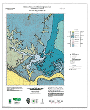
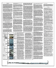
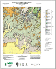
Bedrock Geology of Oraville Quadrangle, Jackson County, Illinois | 36" x 30" two map sheets; sheet 1 contains map and legend; sheet 2 includes descriptive text, descriptive stratigraphic column and a cross section |
Oraville | Bedrock Geology | STATEMAP | Illinois Geologic Quadrangle Series (IGQ) | 2011 | W. John Nelson, Joseph A. Devera, Laura M Williams, James R. Staub |

|
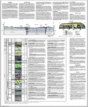
Bedrock Geology of Oregon Quadrangle, Ogle County, Illinois | Two 36" x 30" map sheets; sheet 1 contains map and legends; sheet 2 includes descriptive stratigraphic column, cross section, and descriptive text. |
Oregon | Bedrock Geology | STATEMAP | 2010 | Mary J. Seid | |

|
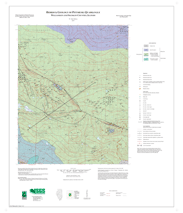
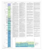
Bedrock Geology of Otterville Quadrangle, Jersey County, Illinois | Two 35" x 30" map sheets, sheet 1 contains map, drift thickness inset, and legends; Sheet 2 includes stratigraphic column, unit descriptions, 1 cross section, 4 figures, and report. |
Otterville | Bedrock Geology | STATEMAP | 2019 | Breeden, J.R., J.A. Devera, F.B. Denny | |
|
Bedrock Geology of Paducah NE Quadrangle, Massac and Pope Counties, Illinois | Two 34" x 28" map sheets; Sheet 1 includes map and legend; sheet two contains descriptive text,cross sections (2) and descriptive stratigraphic column |
Paducah Northeast | Bedrock Geology | STATEMAP | Illinois Geologic Quadrangle Series (IGQ) | 2005 | F. Brett Denny, W. John Nelson |
|
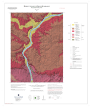
Bedrock Geology of Pittsburg Quadrangle, Williamson and Franklin Counties, Illinois | Two 36" x 30" map sheets; sheet 1 includes map and legends; sheet 2 includes descriptive stratigraphic column, descriptive text, and cross section |
Pittsburg | Bedrock Geology | Illinois Geologic Quadrangle Series (IGQ) | 2007 | W. John Nelson | |


|
Bedrock Geology of Pleasant Dale Valley Quadrangle, Calhoun County, Illinois, and Pike County, Missouri | Two 34" x 28" map sheets; sheet 1 contains map and legends; sheet 2 includes descriptive stratigraphic column, 1 cross section, 6 figures, and descriptive text. |
Pleasant Dale Valley | Bedrock Geology | STATEMAP | 2017 | Mary J. Seid | |
|
Bedrock Geology of Pomona Quadrangle, Jackson County, Illinois | Two 36" x 30" map sheets; sheet 1 includes map and legends; sheet 2 includes descriptive stratigraphic column, descriptive text and cross section |
Pomona | Bedrock Geology | STATEMAP | Illinois Preliminary Geologic Map Series (IPGM) | 2007 | Mary J. Seid, W. John Nelson, Joseph A. Devera |


|
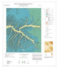
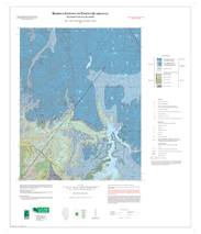
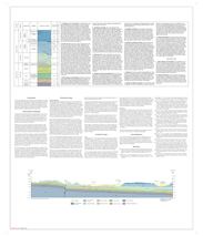
Bedrock Geology of Port Byron Quadrangle, Rock Island and Henry Counties, Illinois | Two 35" x 30" map sheets; sheet 1 contains map, legends, and 2 map figures; sheet 2 includes stratigraphic column with descriptions, report with 1 figure and 12 photos, and 1 cross section. |
Port Byron | Bedrock Geology | STATEMAP | 2022 | Joseph A. Devera, Joseph M. Krienert | |

|
Bedrock Geology of Prairie du Rocher Quadrangle, Randolph and Monroe Counties, Illinois and Ste. Genevieve County, Missouri | 33" x 55" double map sheet; sheet 1 contains map and legend; sheet 2 contains descriptive text, descriptive stratigraphic column, log, text table and cross section |
Prairie du Rocher | Bedrock Geology | STATEMAP | Illinois Preliminary Geologic Map Series (IPGM) | 2004 | F. Brett Denny |

|
Bedrock Geology of Prairietown Quadrangle, Madison and Macoupin Counties, Illinois | 34" x 56" double map sheet; sheet 1 includes map and legend; sheet 2 includes descriptive text, inset maps (2), descriptive stratigraphic column, and cross section |
Prairietown | Bedrock Geology | STATEMAP | Illinois Preliminary Geologic Map Series (IPGM) | 2004 | F. Brett Denny |