|
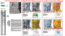
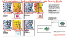
3-D Visualization of Bedrock Resources in Lake County, Illinois |
1:62,500 Lake County map atlas (2 sheets)
|
Three-dimensional Model |
Open File Series (OFS) |
Lake |
2003 |
Hannes E. Leetaru |
|
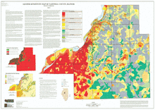
Aquifer Sensitivity Map of Tazewell County, Illinois |
1:62,500 Tazewell County map; 50" x 36" single map sheet; includes map, legend, and inset maps (3)
|
Aquifer Sensitivity |
Open File Series (OFS) |
Tazewell |
2003 |
Patrick D. Johnstone |
|
Aquifer Sensitivity Map, Jo Daviess County, Illinois |
1:62,500 Jo Daviess County map; 59" x 30" single map sheet; includes map, legend, and 3 inset maps
|
Aquifer Sensitivity |
Open File Series (OFS) |
Jo Daviess |
2000 |
Christopher S. McGarry, Matthew H. Riggs |
|
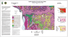
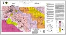
Aquifer Sensitivity of Carroll County, Illinois |
1:62,500 Carroll County map; 53" x 29" single map sheet; includes map, legend, and 3 inset maps
|
Aquifer Sensitivity |
Open File Series (OFS) |
Carroll |
1997 |
Christopher S. McGarry, David A. Grimley |
|
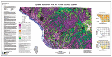
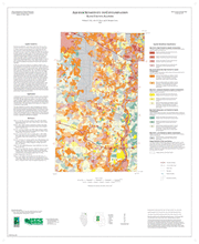
Aquifer Sensitivity to Contamination, Kane County, Illinois |
One 27" x 33" map sheet; includes map, legends and descriptive text
|
Aquifer Sensitivity |
Illinois County Geologic Map Series (ICGM) |
Kane |
2007 |
William S. Dey, Alec M. Davis, B. Brandon Curry |
|
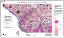
Bedrock Geology Map, Jo Daviess County, Illinois |
1:62,500 Jo Daviess County map; 49" x 29" single map sheet; includes map, legend, and descriptive text
|
Bedrock Geology |
Open File Series (OFS) |
Jo Daviess |
2000 |
Christopher S. McGarry |
|
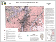
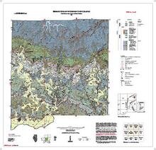
Bedrock Geology of Boone and Winnebago Counties, Illinois |
1:100,000 Boone and Winnebago Counties area map; 33" x 36" single map sheet; includes map, legend and inset map
|
Bedrock Geology |
Open File Series (OFS) |
Boone, Winnebago |
2000 |
Christopher S. McGarry |
|
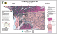
Bedrock Geology of Carroll County, Illinois |
1:62,500 Carroll County map; 45" x 27" single map sheet; includes map, legend, descriptive text, stratigraphic column, and inset map
|
Bedrock Geology |
Open File Series (OFS) |
Carroll |
1997 |
Christopher S. McGarry |
|
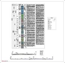
Bedrock Geology of Johnson County, Illinois |
Two 40" x 40" map sheets; sheet 1 contains map, legends, and 2 figures; sheet 2 includes 1 geologic column, legend, and 2 cross sections. Accompanying 38-page report includes discussion, references, 14 figures, 3 tables, and appendix.
|
Bedrock Geology |
|
Johnson |
2021 |
W. John Nelson, Joseph A. Devera, Charles F. Hoffman |
|
Bedrock Geology of Lee County, Illinois |
1:62,500 Lee County area map; 55" x 30" single map sheet; includes map, legend, descriptive text, stratigraphic column and inset map
|
Bedrock Geology |
Open File Series (OFS) |
Lee |
1999 |
Christopher S. McGarry |