County mapping is carried out at the ISGS under a variety of programs. The programs exist for different purposes and require different levels of scientific review. Maps are published in specific Series based on the program under which they were created and the corresponding level of review.
Embed a View
Search for keywords in titles, authors, descriptions, and publication year below. For more detailed searches on themes, quads, series, programs, counties, and states, click the "Advanced Search" option.
Displaying 1 - 10 of 86
| Map Images |
Title |
Description |
Theme |
Series |
County |
Publication Date
Sort descending
|
Authors |

|
Surface Topography of McHenry County, Illinois |
|
Surface Topography |
Open File Series (OFS) |
McHenry |
1995 |
Melisa M. McLean, Maureen D. Kelly, Christopher S. McGarry |

|
Shaded Relief of Carroll County, Illinois |
1:62,500 Carroll County map; 37" x 27" single map sheet; includes map, legend, and descriptive text
|
Shaded Relief |
Open File Series (OFS) |
Carroll |
1997 |
Christopher S. McGarry |

|
Ground Surface Topography of McLean County, Illinois |
1:100,000 McLean County map; 43" x 26" single map sheet; includes map, legend, descriptive text and inset map
|
Surface Topography |
Open File Series (OFS) |
McLean |
1997 |
Melisa M. McLean, Matthew H. Riggs |

|
Bedrock Topography of Carroll County, Illinois |
1:62,500 Carroll County map; 37" x 27" single map sheet; includes map, legend, and 3 inset maps
|
Bedrock Topography |
Open File Series (OFS) |
Carroll |
1997 |
Christopher S. McGarry |

|
Surface Slopes of Carroll County, Illinois |
1:62,500 Carroll County map; 37" x 27" single map sheet; includes map, legend, and descriptive text
|
Surface Slopes |
Open File Series (OFS) |
Carroll |
1997 |
Christopher S. McGarry |
|
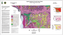
Aquifer Sensitivity of Carroll County, Illinois |
1:62,500 Carroll County map; 53" x 29" single map sheet; includes map, legend, and 3 inset maps
|
Aquifer Sensitivity |
Open File Series (OFS) |
Carroll |
1997 |
Christopher S. McGarry, David A. Grimley |

|
Land Cover of Carroll County, Illinois |
1:62,500 Carroll County map; 37" x 27" single map sheet; includes map, legend, and descriptive text
|
Land Cover |
Open File Series (OFS) |
Carroll |
1997 |
Christopher S. McGarry |

|
Location of Data Points in McLean County, Illinois |
1:100,000 McLean County area map; 40" x 29" single map sheet; includes map, legend, and descriptive text
|
Data Points |
Open File Series (OFS) |
McLean |
1997 |
Melisa M. McLean, Matthew H. Riggs |

|
Surface Topography of Carroll County, Illinois |
1:62,500 Carroll County map; 37" x 27" single map sheet; includes map, legend, descriptive text, and inset map
|
Surface Topography |
Open File Series (OFS) |
Carroll |
1997 |
Christopher S. McGarry |

|
Thickness of Quaternary Materials in McLean County, Illinois |
1:100,000 McLean County area map; 40" x 27" single map sheet; includes map, legend, descriptive text, and inset map
|
Quaternary DepositsDrift Thickness |
Open File Series (OFS) |
McLean |
1997 |
Melisa M. McLean, Maureen D. Kelly, Matthew H. Riggs |